 |
 Illustrations
and Maps
Adam Mickiewicz
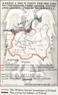
This map, which takes the place of a picture postcard (the back was printed as such) is widely distributed for propaganda purposes in Poland. An inflated Poland, stretching to the very doors of Berlin, is depicted. The "historical boundaries" are intended to awaken the impression that Poland is entitled to these areas in the West. The eastern boundaries on the same "historical basis" have been tactfully omitted, so as to avoid offending the Eastern neighbours.
One unconsciously asks whether Poland believes that British blood should be
shed to defend these imaginary
frontiers - especially since the demarcation of such boundaries would
unquestionably lead to more wars. The quotation shows that the "historic
frontiers" are regarded rather more from the point of view of the future than of
the past.
 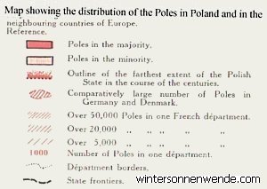
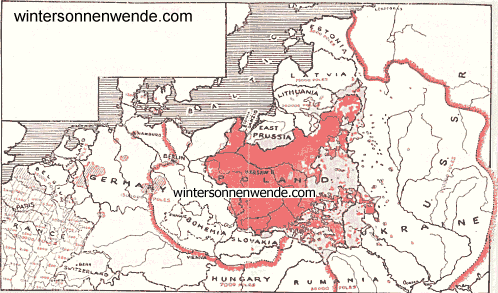
[Click map to enlarge.] This map is based on official data and statistics. It shows the actual position clearly. Broad stretches of land, which belonged to the Rzeczpospolita for centuries, are to be seen on it. It will also be seen that present-day Poland, which is precisely in the heart of the historical lands, is situated where the Polish element is in a majority.
Present-day Poland is thus the kernel, the rest of the "Polish land" lies in
neighbouring
States - according to Warsaw. The former frontiers are drawn to include
Lithuania, Latvia and Esthonia, East Prussia, Danzig, and such odd stretches of
territory as Germany (as far as Berlin) and former
Czecho-Slovakia, with the boundary just north of Budapest. A big slice of Russia
completes the claim. But, as though to show that these claims were really
somewhat modest, the Polish minority is recorded in the area of Dortmund,
Essen,
Cologne - and the North of France, as far as the English Channel! Hamburg, a
Danish Island, and a few other "minority Polish areas", complete this designation.
The percentage of Poles in these districts is in most cases lower than that of
French or Italians in London, or coloured persons in Cardiff. Such maps have,
absurd as it may seem, attracted no little attention in Poland, where the less
educated citizens accept the claims as well founded.
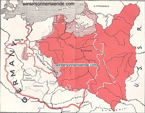
 The Western
frontiers of Poland in history,
and the altered frontiers of the neighbouring States since September 1939. According to Jan Marski. 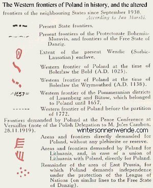
[Click map to enlarge.] A large part of Europe would have to be carved up to meet the demands of the Poles, as illustrated in this map. Big slices of neighbouring countries, where the population is 99.9 per cent. German, for example, are demanded without a plebiscite. This is not so absurd as it might seem - for with a plebiscite, the Poles would hardly expect success with 0.1 per cent. of the votes. But, to show that these demands are fairly modest, they outline their "historical claims", and show a big enclave which would still remain German. Unfortunately, such propaganda is carried out with great skill, and those with little knowledge of history are easily persuaded that one-third of Europe was once Polish. By no means all Poles support this propaganda, but a strong section is actively engaged in trying to make the impression that only a small part of "real Poland" was made independent by the Treaty of Versailles. Actually, much of what is now Poland has more than 50 per cent. non-Poles (see Appendix tables, based on other Polish sources). |


